We prepare full landscape and visual assessments (also known as landscape and visual impact assessments or LVIAs). As chartered landscape architects we have the knowledge and skills to prepare all aspects of LVAs from initial research, scoping, site surveys, photography, ZTVs, plans, wirelines, photomontages, LVA report or for Environmental Statement and Non-Technical Summary. Site surveys include GPS tracking, panorama-head-tripod technical photography and night time surveys.
A brief outline of a range of schemes we have prepared for clients over a number of years can be found below.
The term ‘Landscape and Visual Impact Assessment (LVIA)’ is the industry standard terminology. However, we have always termed this assessment as ‘Landscape and Visual Assessment’, dropping the ‘Impact’ which can be misleading. Immediately, the use of the word ‘Impact’ implies that there would be an impact, which is not always the case.
We work with a range of clients from large developers and energy companies to private landowners and house builders. The range of work that we have prepared LVAs for include:
Renewable Schemes (Wind, Solar and Anaerobic Digestion)
Our landscape architects have many years of collective experience in preparing landscape and visual assessment for renewable schemes, particularly for wind turbines.
We have many examples of Landscape and Visual Assessments for planning applications across the UK in different local authorities including Westmorland and Furness Council, Cumberland Council, East Riding of Yorkshire, County Durham, Ayrshire, Dumfries and Galloway, Staffordshire, Lincolnshire, Perthshire, North and South Lanarkshire, The Highlands, Lancashire, Merseyside, Essex, Gwent, South Glamorgan, Mid Glamorgan and West Glamorgan.
Most Landscape and Visual Assessments include field surveys, GPS, photographic surveys, research, preparation of supporting plans, technical illustrations and visualisations.
Visualisations are prepared following latest guidelines and using wirelines and photomontages.
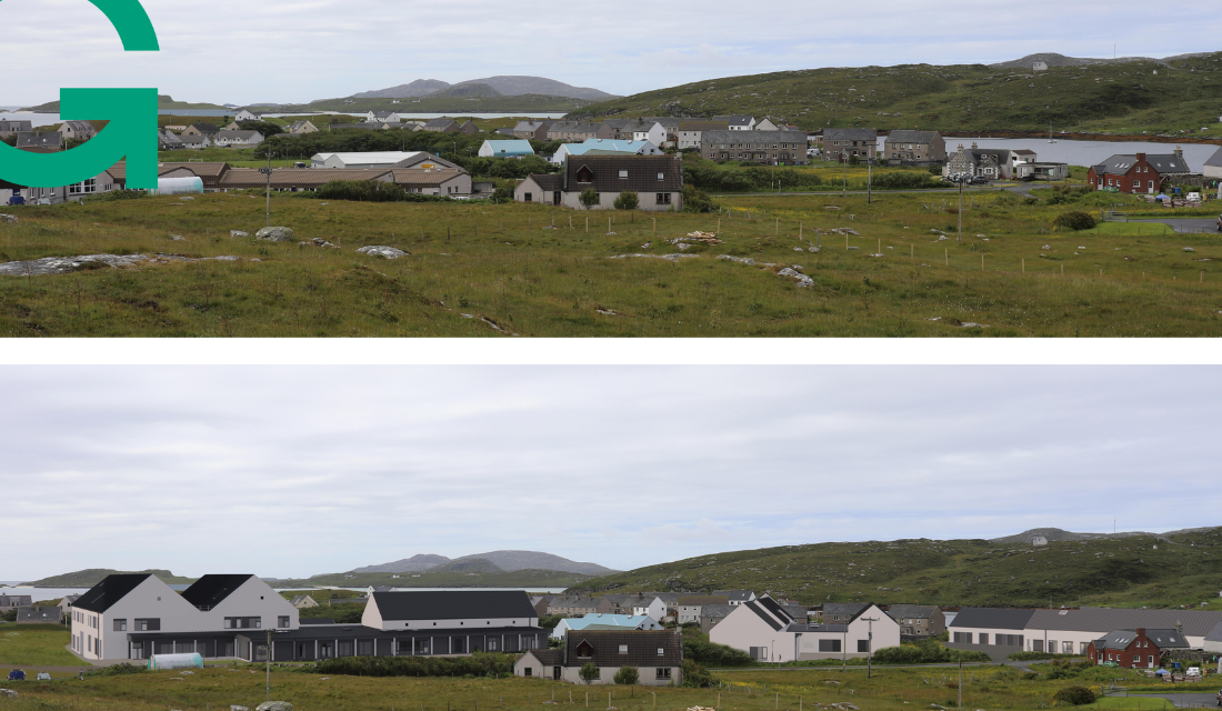
Community and Educational Developments
This example scheme was for the Isle of Barra, we prepared a full LVA and prepared wirelines / photomontages to assess the anticipated potential effect upon the landscape likely to result from a proposed Community and Education Development.
Similar LVA schemes have been prepared for houses and housing developments, business parks, service stations, artworks, power stations, renewables, agricultural buildings and leisure parks. In fact, we could prepare LVAs for any form of development.